Avalanche Weekly Summary - January 30, 2025
Northern Mountains
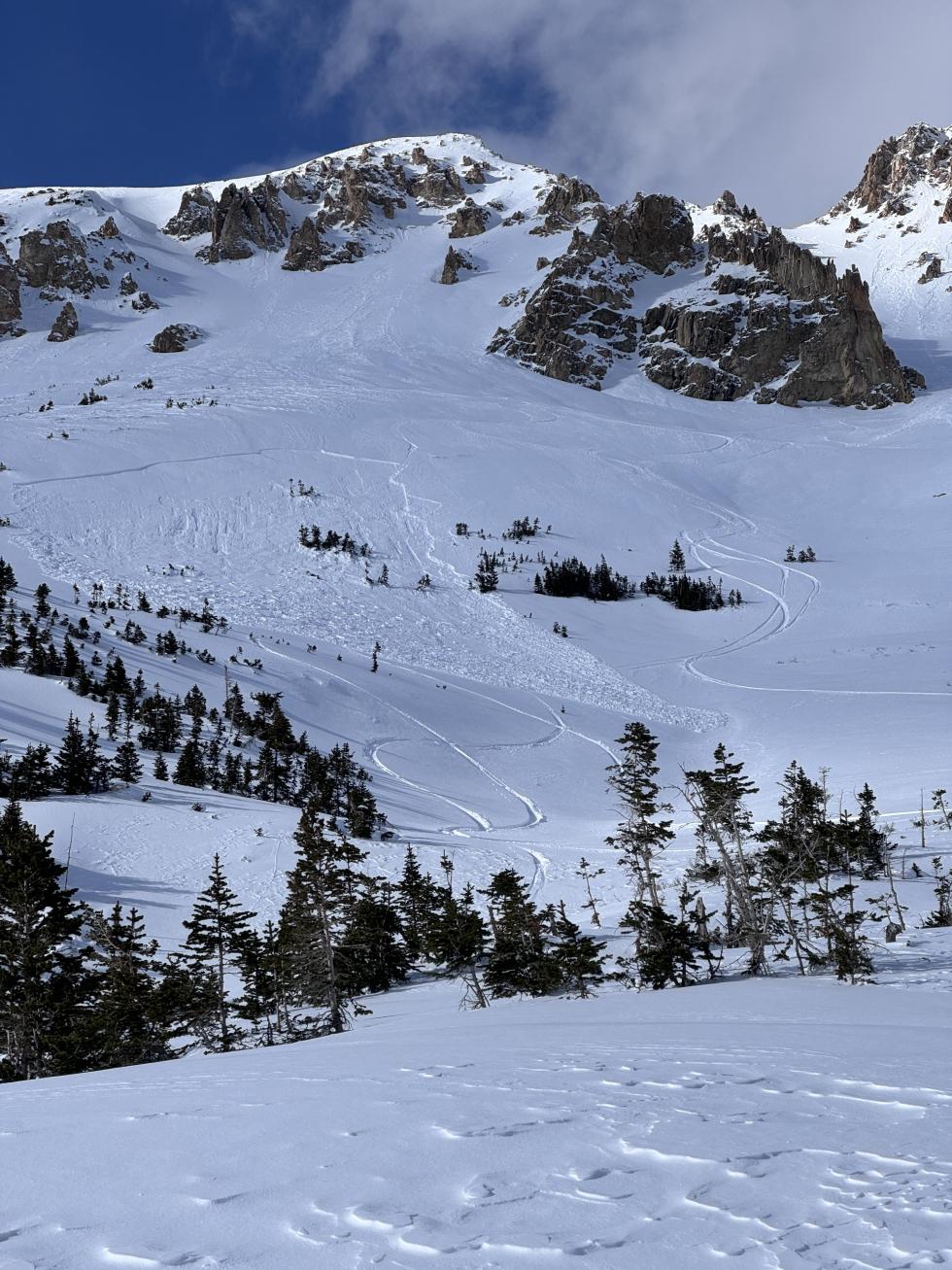
The Northern Mountains were the hot spot for snow and avalanche activity again last week. A storm over the weekend dropped around 18 inches of snow on the Park Range, the Never Summer Range, and areas of Rocky Mountain National Park. Most other areas received 3 to 6 inches. This new snow further buried a layer of faceted snow that formed in mid-January. This layer rests under a crust on southeast-facing slopes, which is where we saw the most avalanche activity. In some cases, smaller slides gouged down to deeper persistent weak layers. In the past week, 36 avalanches were reported, 11% reaching D2 or larger. Seven were human-triggered, five on the south side of the compass, including a snowboarder who was caught and carried in a southeast-facing slope. Thankfully he was uninjured.
Central Mountains
Last weekend’s storm dropped only an inch or two across the Central Mountains. Westerly winds drifted snow onto north through southeast-facing slopes. In wind-sheltered terrain, the snowpack continued to facet and weaken. Of the 22 avalanches this week, 17 released on northeast or east-facing slopes. Thirteen were human-triggered but relatively small (D1–D1.5). One skier was caught but not buried on Greg Mace Peak near Aspen.
Southern Mountains
Snowstorms in January largely missed the Southern Mountains until the past few days when the region became the bullseye in Colorado. The mid-week storm brought 4 to 10 inches of snow to the region with moderate to strong winds that drifted the new snow into fresh slabs and increased the avalanche danger. Notable events include a dramatic natural slide on Ajax Mountain near Telluride and one backcountry tourer who was caught but not buried near Alta Lakes, north of Ophir.
Heading Into the Weekend
Wind-drifted slopes remain the most dangerous places statewide, particularly those facing the eastern half of the compass. Another storm is forecast in the Northern Mountains this weekend, where westerly winds will pick up Friday night and drift snow onto easterly slopes. This new snow and wind will exacerbate the upper snowpack’s Persistent Slab problem and also increase the avalanche danger in the Park Range due to higher snow totals. Moving south to the West Elk and Elk Mountains, one thing to note is that Loose Dry avalanches are increasing in size, especially on slopes that have already slid this season. In the Southern Mountains, rapid warming this weekend could trigger Loose Wet avalanches. These slides will be scattered around the region, small in size, and most common in the areas that received the most new snow earlier in the week.